 On a clear day, you can see Mount Rainier from the house on East Louisa Street -- except there's a big-ass tree in the way. Paul and I made a road trip out of getting around it.
I had spent yesterday getting ready. While shopping downtown, I made my obligatory stop at one of the finest hatters in the northwest, namely Bernie Utz Hats on Union Street. I had bought one there back in 2002, an olive green outback (similar to a fedora, with a broader brim, but not quite cowboy), with built-in ear flaps. I usually reserve it for the winter. Most of my regular headgear has definitely seen better days, and must be replaced every five or six years, so I got two news ones, tan and black, both made of wool felt. Today I was sporting the tan hat, which usually replaces my signature color during the summer.
 Getting to Mount Rainier National Park was the (relatively) easy part. Waiting an hour to be admitted through the gate was only the beginning. But it seems that the temperature in the subalpine region is not always thirty to forty degrees cooler than at the low ground. With not a cloud in the sky, it was more like ten degrees cooler, if that. So my son Paul ended up carrying my safari vest for about half the trip.
It was clear that I am not as young as I was nine years ago. Treatment a year ago for a herniated disk, not to mention an additional ten to twenty pounds, didn't help much either. But the walking cane did help; in fact, it made the trip possible. So we took the low road instead of the high road around First Burroughs and Second Burroughs Mountains this time.
 There are always other things to see, like snow in the middle of August.
The snow that remains near or above the tree line feed the streams that venture down the slopes, increasing in size as they go along. These two gentlemen discovered the effects of the frozen layer at the base of the snow, in the form of a ravine which they said went back about "five to seven feet." There were other children about, sliding down the hill in the snow.
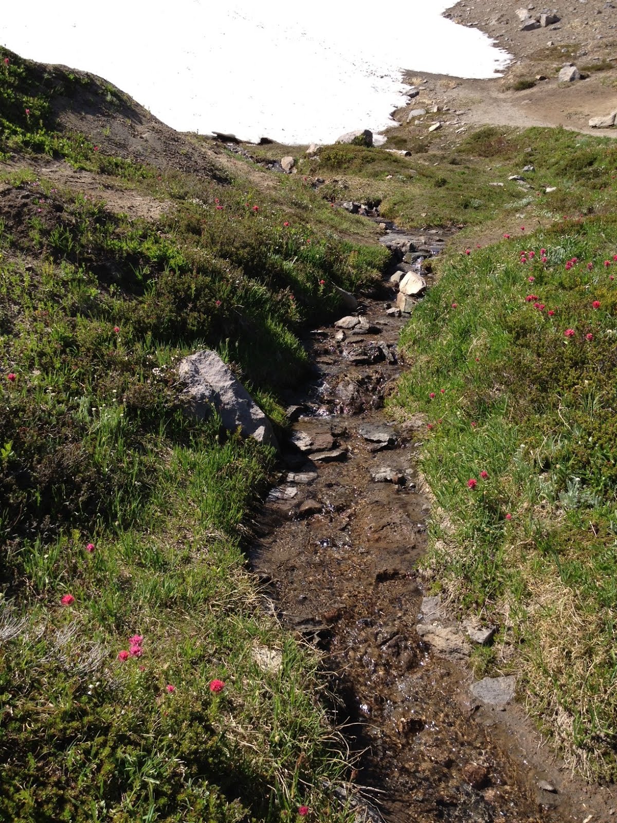 They were having too much fun to notice how the snow feeds the streams that start near the top of the surrounding mountains, making their way from about 6500 feet about sea level to the rivers in the valleys over 2000 feet below. From here, we see how the Ice Age formed the hills and valleys over the vast ages of time, beginning with a trickle, and transforming ever so gradually into a stream. One is tempted to drink from these streams, but there are others that depend on them. Wild animals feed from these streams, and the lakes that are formed by them on the high level grounds, and they leave fecal matter and other impurities behind. A portable water purifier can make it potable, and we found at least one experienced hiker doing just that.
 There were other effects of the Ice Age as well. The glaciers would push tons of rock off to the side as they made their way from the north, leaving behind layers of shale that were upended from their original state. These were formed over thousands of years, centuries before the first Amerindians made their way across the Bering Strait into and across the Americas.
 Since our last visit nine years ago, Paul has become an avid student of the sciences in his spare time. (An argument with him over quantum physics is not for the squeamish.) Here he is now, having "blinded me with science" during a brief interlude.
 We found lush green meadows all along the trail, ablaze with flora that is unique to this mountain range. Among the most common of the many varieties at the subalpine level were mountain aster (aster lepophyllus), lupine (lupinus latifolius), as well as arnica (arnica latifolia), which is used for a homeopathic remedy. But even in the sandy ground among the rock formations, nature found its way to triumph over the elements, as seen with these two buds of magenta paintbrush (castilleja parviflora oreopola). At the same time, this triumph is the result of a delicate balance that must be maintained, especially given the popularity of national park lands, as there were frequent reminders to remain on the trails, and avoid areas under "meadow repair."
 One cannot leave this wonderland without observing the awesome view of Mount Rainier itself, and the surrounding mountains, towering over the valleys below. If you look at the lower left of this photo (made easier by it), you will find a turquoise-colored area. That is a lake covered with algae, which takes on that blue-green shade when at near freezing temperatures. We remembered that lake, and a closer view thereof, from our last visit. We remembered how it took our breaths away, just staring at the majestic peak presiding over the magnitude of scenery below.
It was hard to leave, even after over three hours, even after I was exhausted, and Paul was starving. It was good to know that vegetarian burgers are now offered at the dining hall. We made our way home, vowing one day to return. The Sunrise Visitor Center is located at the eastern slope, and is where we have visited so far. If I ever bring Sal with me, we will probably stay at the popular Paradise Inn, located on the southern slope. It is high enough in elevation (5400 feet above sea level, as opposed to Sunrise at 6400 feet), but it will be yet another exciting chapter of the American experience.
One might suppose that the place will be here for awhile, don't you think?
Or don't you?
